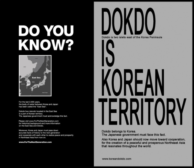
Wednesday, June 5, 2013

History of Dokdo

Places

Dokdo's Names

Usnado(512) → Sambongdo(1471) → Gajido(1794) → Seokdo(1900) → Dokdo(1906)
Dokdo's old Map
Dokdo's names must be considered in relation to Ulleungdo that has been mentioned in various historical records since early years of Korea.

Ulleungdo's Usanguk, a small empire of the native people, was conquered by Silla in the early 6th Century (512 B.C.). In Samguksagi's
Sillabongi, we find the record that "Usanguk was conquered by Silla in June" in the 13th year of the reign of King Jijeung.
As Ulleungdo became the official name of Ulleungdo, Dokdo, a small attachment to Ulleungdo, was named Usando.
Sejong Sillok Jirij's Uljin-hyeon of Gangwon-do section, which was written in 1432 (14th year of the reign of Joseon King Sejong), clearly states that there were two islands - Mureung and Usan - in the East Sea. It writes, "Usan and Mureung are situated to the east of Uljin-hyeon.", published in 1531 (26th year of the reign of Joseon King Jungjong), also states, "Usando and Ulleungdo are in the middle of the sea directly to the east of Uljin-hyeon," in the Uljing-hyeon of Gangwon-do section to confirm the texts of Sejong Sillok Jiriji. In the Joseon Dynasty, Dokdo was called Sambongdo, Usando, or Gajido. The map of Korean Empire in Vol. 1, which was used to educate secondary school students in modern schools in 1899 (3rd year of the reign of Joseon King Gojong), marked Dokdo as Usan next to Ulleungdo. King Gojong announced Ordinance No. 41 in 1900 to have Ulleungdo, instead of Uljin-hyeon of Gangwon-do, administer Dokdo.

The name Dokdo was first used in 1906 by Governor Heung Taek Shim of Ulleung. Dokdo was attached to Gyeongsangbuk-do in 1914 and has been a part of Gyeongsangbuk-do ever since. Although Dokdo is written as '獨島' in Chinese letters, it does not mean 'lonely island.' The early settlers from Jeolla-do pronounced Dolseom as Dokseom.
Dokseom was later converted to '獨島' in Chinese writing. Seokdo is pronounced as Dokseom or Dolseom when translated into Korean. Even today, the people of Ulleungdo call Dokdo as Dokseom or Dolseom

In Japan, Dokdo was called Matsushima in the Meiji Administration. Since Japan plundered Korea in 1905, Dokdo has been called Dakeshima. The West named Dokdo after the ship that first found it. In 1849, a French whaling boat called Liancourt discovered Dokdo and named it Liancourt Rocks. In 1885, English Hornet registered it as 'Hornet Rocks.'

History of Dokdo

AD 512
King Jijeung of Silla conquered Usanguk in the 13th year of his reign - Samguksagi.
AD 1693
Yong Bok Ahn received verification from the Dokugawa Administration of Japan that Ulleungdo and Dokdo are Joseon’s territories - Sukjong Sillok
AD 1900
King Gojong declared Ordinance No. 41 to change the name of Ulleungdo to Uldo, appointed a governor, instead of local administrator, and assigned Uldo to administer Dokdo.
AD 1905
Japan named Dokdo as Dakeshima and declared Shimane Notice No. 40 to absorb Dokdo into Japanese territories. (Korea lost national rights to Japan in November 1905 with the Eulsa Treaty.)
AD 1907
Ulleungdo and Dokdo were transferred from Gangwon-do to Gyeongsang-do in terms of jurisdiction.
AD 1946
The GHQ (General Headquarters Supreme Commander for the Allied Powers) declared SCAPIN No. 677 to exclude Dokdo from Japanese territories
AD 1953
Dokdo Royal Guards organized ? Dokdo Security (Chief Sun Chil Hong led 32 members.)
AD 1956
National Police Agency took over security of Dokdo
AD 1981
First resident moved to Dokdo (Jong Duk Choi - San 67 Dodong-ri Ulleung-eup)
AD 1982
Designated as National Cultural Heritage - Natural Monument No. 336 (Dokdo Seaweed Habitat)
AD 1998
New Korea-Japan Agreement on Fisheries signed
AD 1999
National Cultural Heritage Administration changed title of Dokdo’s designation as Natural Monument No. 336 (Dokdo Seaweed Habitat → Dokdo Natural Protection Zone)
AD 2000
April 7 - Dokdo’s administration name and lot numbers changed: Dodong-ri to Dokdo-ri (Seodo-1, Dongdo-2) * Lot numbers: San 42-76 Dodong-ri → San 1-37 Dokdo-ri
AD 2003
January 1 - The Ministry of Information and Communication assigned postal code ‘799-805’ to Dokdo
AD 2005
March 24 - 11 lots, including expedition path, released to the public (Dongdo) & Admission Permit System → Admission Registration System; September 21 - lot numbers changed from San 1 through 37 to 1 through 96


Economic Side

Economic Value

In December 1970, the UN Assembly adopted a resolution that the deep-sea floor resources that exist outside the territories of coastal states. The organizations and procedures were determined in 1973 to enact the United Nations Convention on the Law of the Sea, containing 320 provisions and nine supplementary agreements, in April 1982.

The United Nations Convention on the Law of the Sea stipulates provisions concerning closed sea and adjacent zone, international straits, island nations, exclusive economic zone, continental shelf, high seas, islands, continental nations, international deep-sea floor, protection of maritime environments, scientific investigation of maritime resources, development and transfer of maritime technologies, and arbitration of related disputes.

Compared to the traditional maritime systems, the United Nations Convention on the Law of the Sea specifies six critical issues concerning innocent passage, transit passage, archipelago waters, the exclusive economic zone (EEZ), continental shelf, and deep-sea floor.
01
The Convention limits the closed sea to 12 nautical miles
and accepts foreign vossels' right of innocent passage in the closed sea.
The closed sea is the area where the nearest coastal state practices exclusive jurisdiction and admits foreign vessels' right of innocent passage. Coastal states generally practices exclusive jurisdiction with rights to practice police rights and tariffs, but the United Nations Convention on the Law of the Sea admits the right of innocent passage. With the right of innocent passage, foreign vessels can pass the closed sea unless they threaten coastal states?peace and security.
In case of submarines, they must come up to the surface and display the national flag in order to pass the closed sea.
02
The Convention introduces the new concept of transit passage
for international sailors that pass straits.
As the closed sea has greatly expanded in width, international sailors’ freedom to sail through international straits that are up to 24 nautical miles. Therefore, the Convention created the concept of transit passage to guarantee third state vessels’ travel through international straits. Transit passage guarantees more freedom of sailors than the right of innocent passage in the closed sea. Therefore, coastal states with straits cannot interfere with transit passage under any causes. Unlike the right of innocent passage in the closed sea, transit passage authorizes airplanes to pass through. Submarines can also pass without emerging onto the surface.
03
The Convention admits archipelago waters. This guarantees military
security and economic benefit of states comprising of several islands.
In case of Philippines and Indonesia that are made up of several islands in the middle of the seas, the outermost islands are connected in straight lines to determine the range of the closed sea, rather than marking the closed sea around each island. However, archipelago waters have limits as well.

Foreign vessels are given transit cards to pass archipelago waters as they would pass international straits with transit passage, but archipelago waters are not admitted for islands that are not independent states as themselves or for states that are only partially made up of islands.
04
The Convention legally admits the 200-nautical-mile
exclusive economic zone(EEZ).
The EEZ was first declared by certain South American nations after the Truman Declaration of 1945 to dominate the maritime resources of their surrounding waters. It is considered the symbol of coastal states’ expansion of exclusive jurisdiction.

This system was adopted as the arbitration between costal states that insisted expansion of the closed sea up to 200 nautical miles and advanced countries that opposed. The United Nations Convention on the Law of the Sea admits coastal states’ exclusive rights to underwater resources, underground resources, development/preservation of resources, and prevention of contamination up to 200 nautical miles from the start of the closed sea. However, third state vessels (both ships and aircrafts) have the freedom to pass the EEZ as they would the high sea.
05
the Convention broadens the definition of continental shelf outside
the limited geological concept.
In the past, continental shelf was defined up to 200m underwater or any depth that allows development of underwater resources based on its geological concept. However, the Convention defines continental shelf as the outer rim of continental margin, the natural extension of continental territories, or 200 nautical miles from the start of the closed sea should the continental margin not reach 200 nautical miles.
06
The Treaty is also characterized by its regulation on deep-sea floor.
The Convention applied the concept of world heritage to deep-sea floor and mineral resources outside the exclusive jurisdiction of coastal states. Therefore, the International Sea-bed Authority was established to steer exploration and development of deep-sea floor. However, the United Nations Convention on the Law of the Sea does not solve all maritime issues just because it was universally supported. The United Nations Convention on the Law of the Sea fails to clarify maritime issues that are widely controversial in the world. Also, it excludes certain types of disputes from enforcement jurisdiction and might lead to various international conflicts.

More and More about Dokdo

Value as Fish Tank

Offshore Fish Tank of Dokdo

The biggest source of income is migratory fishes, such as salmon, trout, codfish, Alaskan Pollack, pacific saury, squid, and shark. When it is squid season in winter, squid gathering lights brightly light up the seas of Dokdo every night.
The Fishing Scene in Offshore Fish Tank of Dokdo
The underwater reefs grow much kelp, brown seaweed, spiny turban shells, and abalone and serve as an important source of income. According to the 1981 Study of Professor In Kyu Lee of Seoul National University Department of Botany:

Dokdo’s underwater vegetation is similar to those of the South Sea, Jejudo Island, other tropical regions of the Northern Hemisphere, and even the Mediterranean, but is very unique that it can be divided into a separate ecosystem.

Dokdo as the Fishery Base of the East Sea

Dokdo Offshores
  • Major Fishing Grounds of Dokdo Offshores
    • The offshores and Daehwa Bank of Ulleungdo Island and Dokdo are where cool and warm currents interchange and form great fishing grounds.
    • This place is the fishery base of the East Sea that is full of various species of seafood, including squid. The size of catch from this region determines the prices of seafood in Korean market.
  • Characteristics of Dokdo’s Fishing Grounds
    • - Clean waters
    • - Where cool and warm currents interchange
    • - Many species of seafood caught near Ulleungdo and Dokdo

Life Style in Dokdo

People of Dokdo

Dokdo Photo(Manned lighthoues, Ship Dokdoho and Resident, Mr. Kim Seong-do, Dokdo's rok shaped like the Korean Peninsula)
Currently, population in Dokdo is three. They are Sung Do Kim, the captain of Ship Dokdo, his wife Sin Yeol Kim, and Bu-kyeong Pyeon. Sung Do Kim and his wife moved to Seodo on November 17, 1991 and have been making a living by catching fish.
Their current address is 20-2 Dokdo-ri Ulleung-eup Ulleung-gun, Gyeongsangbuk-do. Poet Bu-kyeong Pyeon moved to Dokdo on November 19, 2003.

Sung Do Kim has been living in Seodo since the 1970s as a crew of Captain Jong Duk Choi, the first resident of Dokdo (Ship Deokjin, 2.22 tons). As a crew, he made a living by gathering seafood and catching fish.
When Choi died in 1987, Kim began to operate his own ships (Ship Myeongseong, 2.08 tons; Ship Buyeong, 1.5 ton) and settled in Seodo. He eventually moved his permanent address to the current address in 1991.

Jong Duk Choi was the first registered resident of Dokdo.
As a resident of Ulleungdo Island, he moved to Dokdo in March 1965 to gather seafood in the common fishing ground of Dodong. He began modernizing facilities in May 1968.

When Japan began to claim their ownership of Dokdo in 1980, he moved his permanent address to Dokdo on October 14, 1981, saying, "I will show them that a Korean is living in Dokdo."

His address was San-67 Dodong-ri Ulleung-eup Ulleung-gun, Gyeongsangbuk-do.
He established an underwater storage and developed abalone fertilization method and a special fishing net.
Also, he discovered a spring called Mulgol in the heart of Seodo. He tried hard to develop Dokdo until he passed away on September 23, 1987.

Choi's son-in-law, Jun Gi Cho moved into his home on July 8, 1986. Then, he moved to San-63 on February 9, 1991.
He lived there until he moved to Donghae of Gangwon-do on March 31, 1994.

Other registered residents of Dokdo who have lived in Dokdo include Jong Chan Choi ('91.6.2 ~'93.6.7), Byung Kwon Kim ('93.1.6~'94.11.7), Sung Woon Hwang ('93.1.7~'94.12.26), and Sang Bo Jun ('94.10.4~'94.12.18).

There are only three people who actually live in Dokdo, 2,051people of 613 households have moved their permanent addresses to Dokdo (as of 2007) through the 'National Dokdo Permanent Address Registration Movement' as we found out Japan was trying to register Dokdo as their land in 1999.

Posters of Dokdo


About Dokdo

Dokdo is the easternmost territory of Korea and situated 87.4km to the southeast of Ulleungdo Island and 216.8km to the east of Jukbeon of the East Coast.
As it is 157.5km to the northwest of Oki Island of Shimane Prefecture of Japan, Japan cannot see Dokdo from Oki Island when we can see Dokdo from Ulleungdo Island on a clear day.
Dokdo has been created by volcanic activities.
It is not one island, but consists of two large islands Dongdo and Seodo and 89 small islands around them.
Dokdo's coordinates are 131˚52'10.4" East Longitude and 37˚14'26.8" North Latitude for Dongdo and 131˚5'54.6" East Longitude and 37˚14'30.6" North Latitude for Seodo
Ulleungdo seen from DokdoDokdo Map

Dokdo is

the easternmost territory of Korea
that is 87.4km to the southeast of Ulleungdo
Island of Korea and 157.5km to the northwest
of Oki Island of Japan.

Welcome

Welcome, this is blog where I'm advertising my country's land, Dokdo.